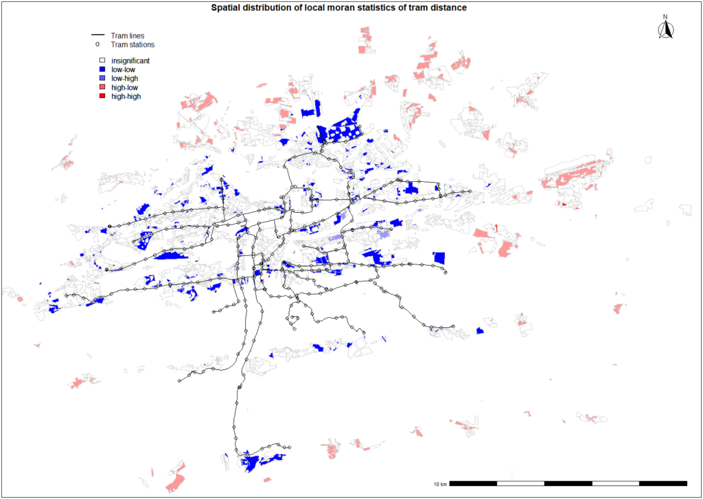
From visual inspection of the spatial distribution for nearest tram stop distance, it seems that the majority of the residential land areas is well connected to the tram network as these polygons tends to have short distance and they are neighboured by polygons with same characteristics in terms of tram network’s connectivity. Polygons with higher values of Moran statistics tends to be arranged in the north and east outskirts of the city. It can be seen from the figure that tram lines are missing in these neighbourhoods and their inhabitants have to rely on buses and individual forms of transportation. As mentioned before, these areas had been connected during the city expansion in 1922 or later, however it seems that no progress of expanding the tram network north east from center has been achieved since then. The situation will most likely remain same as no solution has been proposed yet and these areas aren’t included in the Official Development brochure for the next decade 1.