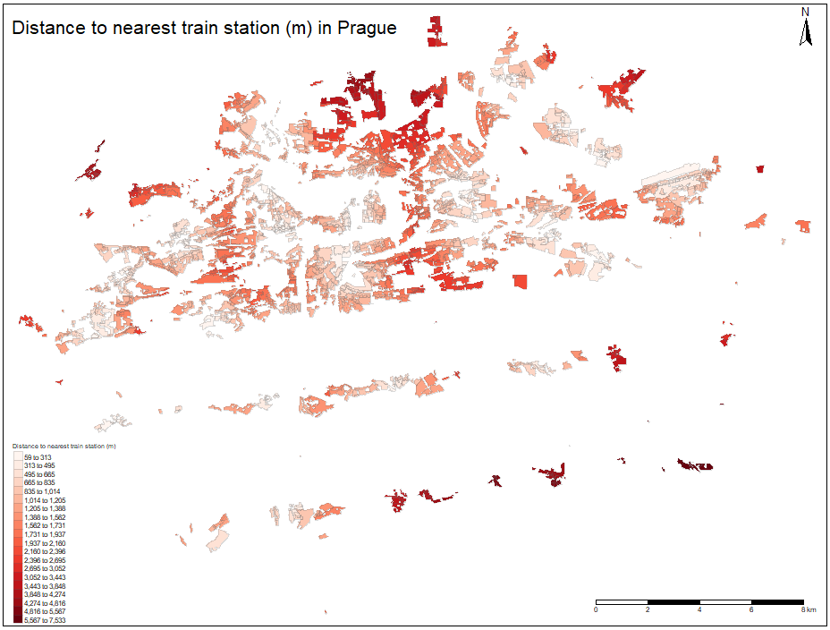
The spatial distribution of the nearest train station distances for each polygon is depicted on the figure below. When inspecting the picture, it seems that the values are scattered as no low distances cluster of polygons is apparent and any other spatial pattern is not clear on the first look. When comparing with tram and metro spatial distribution of distances, we can observe that the areas on the eastern end of the city, near the border with Central Bohemian Region is better connected to the train network, rather than any other mode of public transport. This corresponds with the fact, that this part of the city has suburban character and it was designed for its residents to commute by rail.
Autorof thumbmail picture: Petr Novák: