
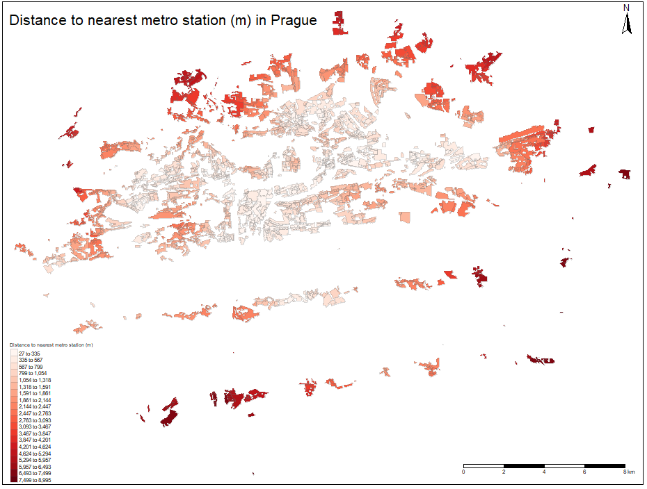
On the figure below, spatial distribution of the nearest metro distances for each polygon is plotted. The lowest values can be seen on the eastern bank of the Vltava river. By visual observations it can be concluded that the distance to nearest metro station is increasing with increasing radius from city center as the lowest values can be observed there. This development makes perfectly sense from the historical point of view as well as the stations were build initially in the center with so called switching triangle (stations Můstek, Muzeum, Florenc). This concept of development was typical in many former Eastern Block cities 1. For better insight, watch the referenced animation 2.